Lodge Pole Point Project
Highlights:
- Multiple EM Conductors
- Shallow basement depth (50-180m)
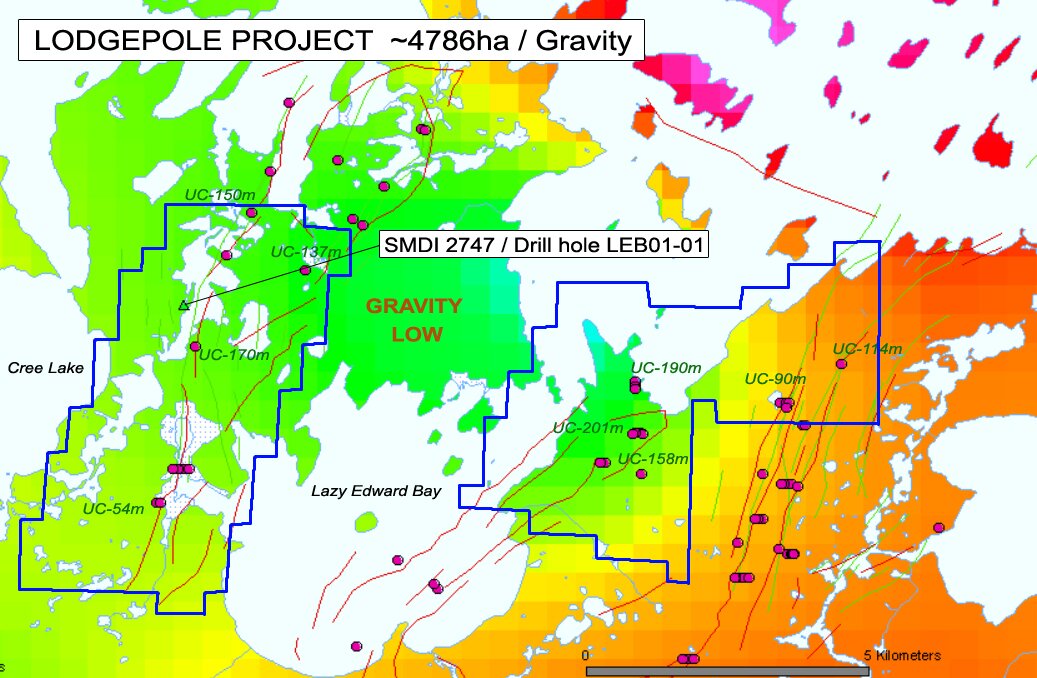
- Base/Heavy Metal Enrichment within gravity low
- Highly Altered Sandstones + Clays + High [Graphite]
- 3 Prospective Zones Identified by gradionometer survey
- Alteration confirmed by 2001 drilling by JNR
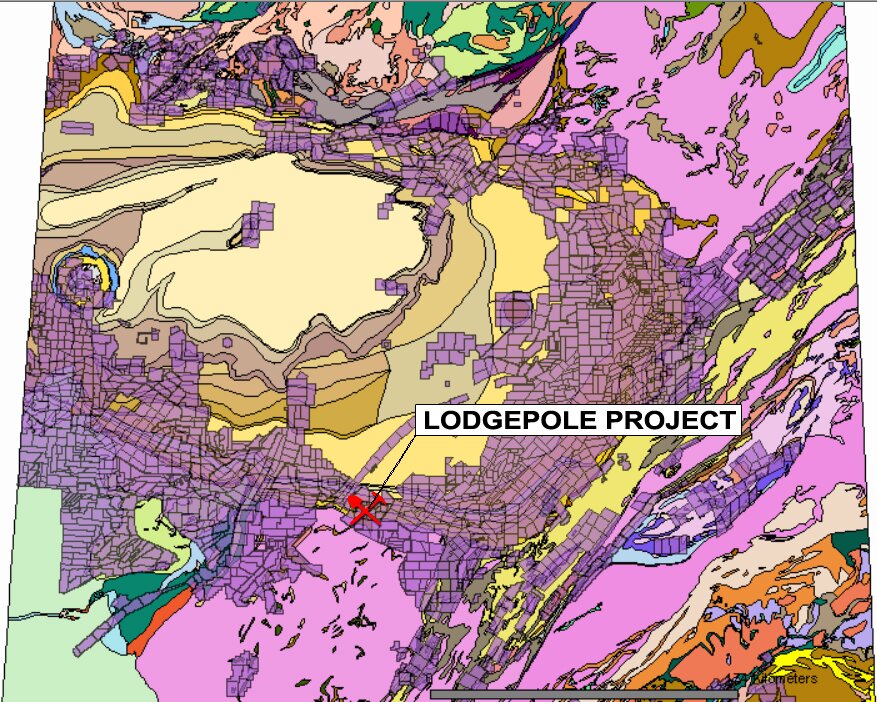
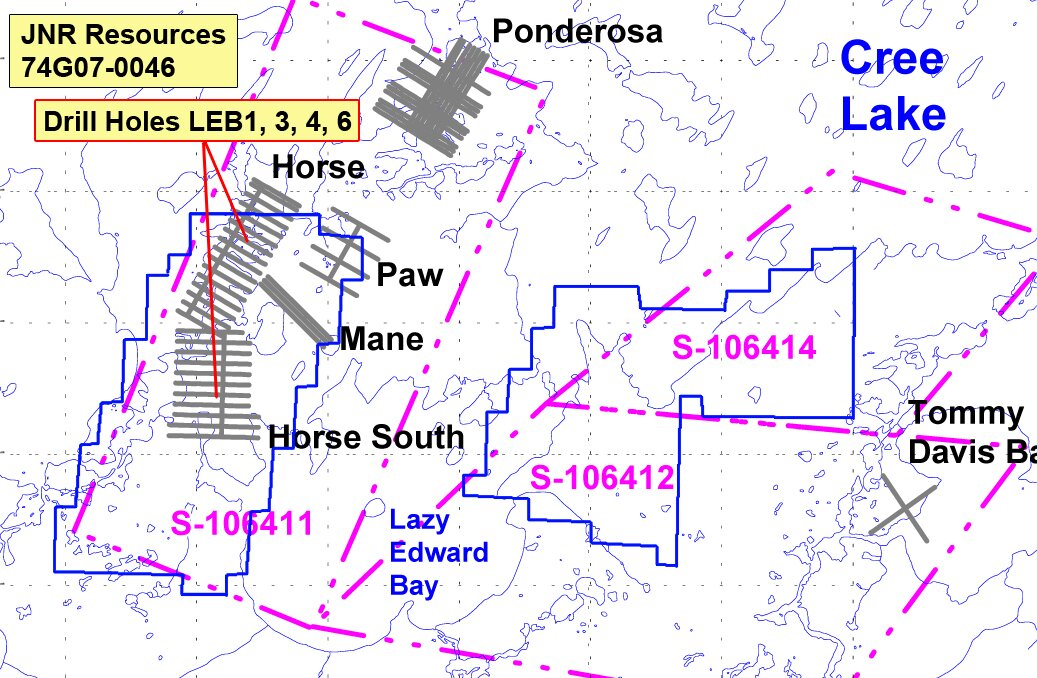
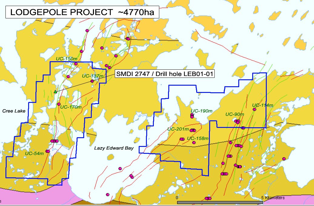
The primary exploration zone at Lodgepole is in an around the area of drill hole LEB01-01, which was spudded on the ice of Lodgepole lake immediately east of the west shore of the lake and 950 m (0.59 mile) northeast of the south tip of this locally named lake. The discovery drill hole is located at Horse South grid coordinates 29700N and 6700E. The drill hole is located approximately 6.1 km (3.8 miles) southeast of drill hole DF-63 (SMDI 2540) and approximately 12.1 km (7.5 miles) northwest of SMDI 2062 or the Lazy Edward Bay radioactive diabase boulders showing.
The showing area, as reconnaissance mapped in 1977 by C.F. Gilboy, is underlain by a series of weakly to moderately bleached, maroon banded, Paleohelikian Athabasca Group Manitou Falls Formation andstones. Manitou Falls Formation MFa member consists of a series of fluvial sandstones that contain minor interbeds of pebbly sandstone, conglomerate, and interclast-rich sandstone. The rocks in the showing area have been crosscut by a series of north- to northeast-trending shear zones. Regionally, a series of diabase dykes, which form the Cree Lake dyke swarm, have been injected into both the basement phyllites and into the overlying Athabasca Group sandstones.
Drill hole LEB01-01 encountered 61.3 m (201.1 ft) of water and overburden on top of the Ahtabasca Group sandstones. Immediately below the overburden, the drill hole encountered 72.7 m (238.5 ft) of pink to red to grey to white, weakly to strongly bleached, weakly to strongly desilicified, and weakly fractured Manitou Falls Formation unit Mfb sandstone that contains up to 5% interstitial clay. This is underlain by 11.7 m (38.4 ft) of white to grey to pink, moerately pervasively bleached, moderately to strongly desilicified and weakly fractured Manitou Falls Formation unit Mfa sandstone that contains 10 to 20% interstitial clay. The unconformity occurs at 145.7 m (478.0 ft).
|
DRILLHOLE |
INTERSECTION |
WIDTH |
Cu |
Ni |
Pb |
Co |
V |
As |
Zn |
U |
|
NUMBER |
(M) |
(M) |
ppm |
ppm |
ppm |
ppm |
ppm |
ppm |
ppm |
ppm |
|
LEB01-01 |
187.0 - 187.4 |
0.4 |
263 |
63 |
33 |
49 |
99 |
6 |
6070 |
1.9 |
|
197.7 - 197.9 |
0.2 |
266 |
65 |
33 |
52 |
102 |
6 |
6180 |
1.8 |
Below the unconformity, the hole encountered 18.3 m (650.0 ft) of grey to green, moderately bleached, chloritized, hematized, and sausseritized, mylonitized Mudjatik domain pelite with sections of anatexite. The initial 8.0 m (26.2 ft) of pelite located immediately below the unconformity exhibits, locally, up to 60% clay replacement. Locally, breccia zones are clay and hematite infilled.
This unit is underlain by at least 36.0 m (118.1 ft) of chloritized and biotite altered, locally garnetiferous and cordieritic graphite semipelite to pelite that contains up to 65% graphite. The graphite pelite is strongly mylonitized and fault gouges often contain up to 65% graphite and 3 to 15% clot and stringer style pyrite mineralization. The mineralization present in the graphitic pelite consists of 2 to 10% graphite and up to 15% pyrite that infills two zones of brecciation. The mineralized interval of graphite breccia returned the values above.
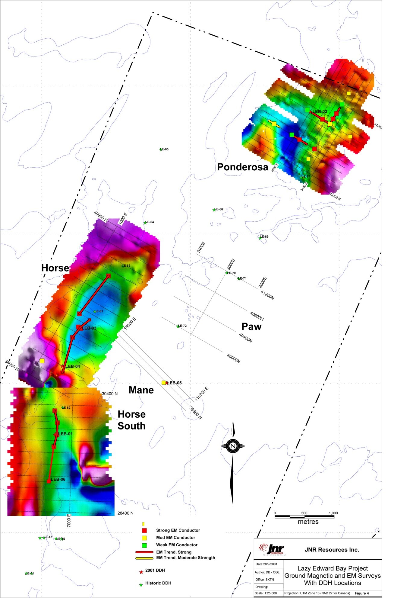
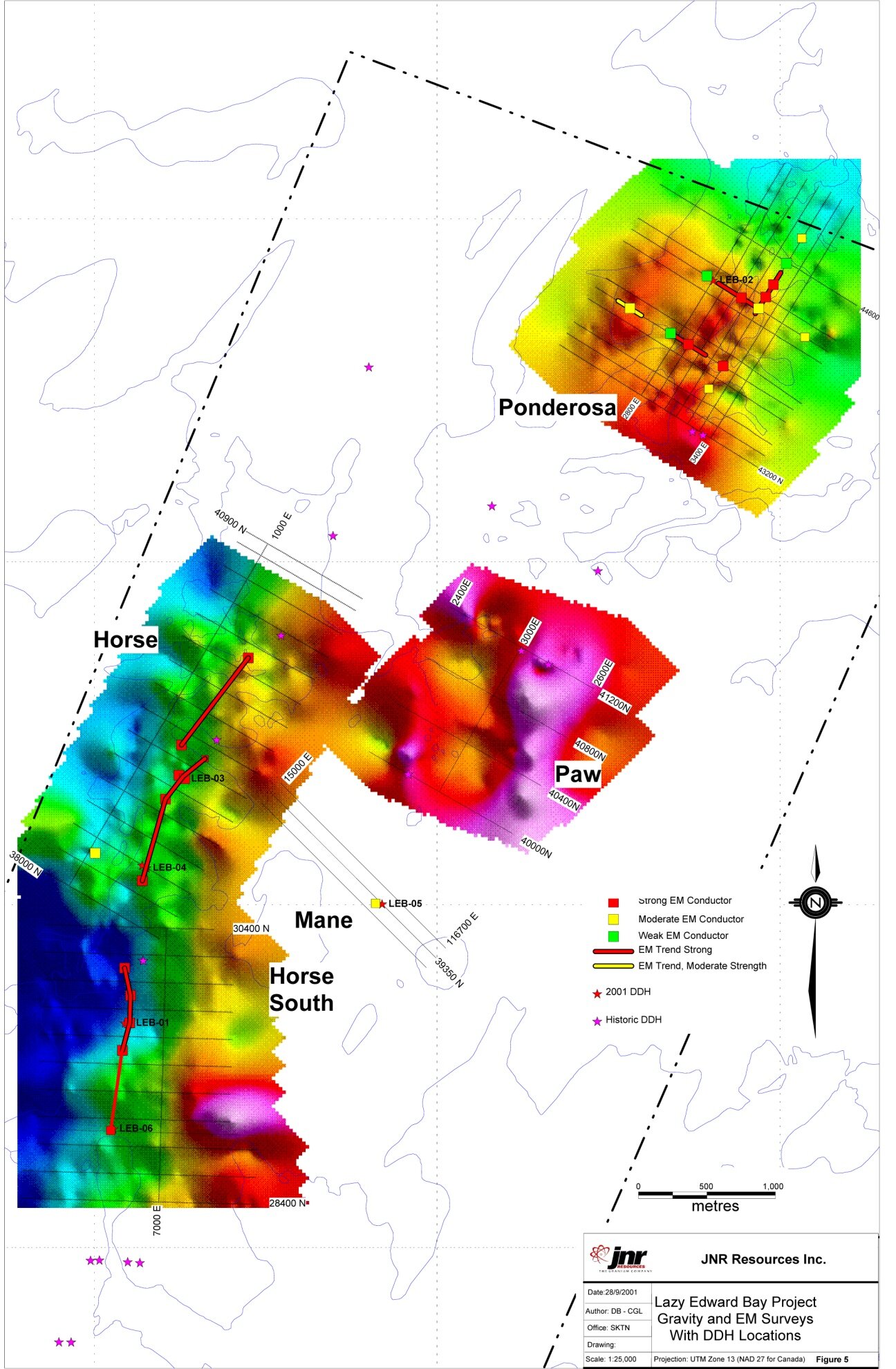
In 2010, JNR Resources completed a Magnetic Gradiometer Survey of the project area. Interpretation was competed by Condor Consulting, Chris S. Ludwig Consulting Geophysicist.
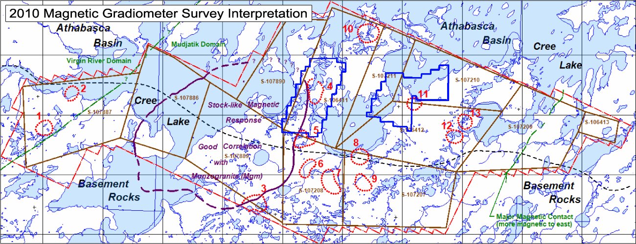
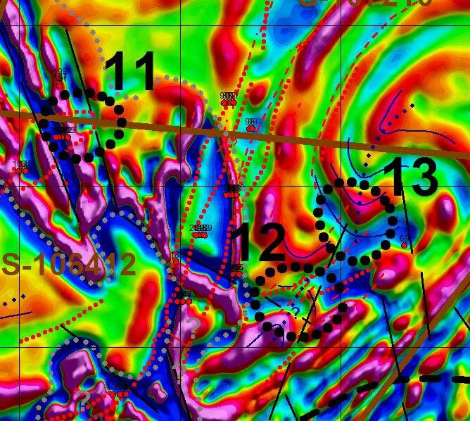
The interpretation identified 3 zones of interest, 4, 5, and 11, which occur partially or entirely within the project area.
Zone 4:See figure below on following page (page 12). Zone 4 is an area just east of the eastern margin of the large stock-like magnetic high region (Mgm?) where a major N-S conductor zone is cut by prominent NNW-trending magnetic linears. The main VTEM conductor is interpreted by Condor as having an intermediate east dip; it may be the western flank of a large synclinal fold the axis of which is likely just east of the target. Other correlating and sub-parallel conductors are seen along and mainly east of the VTEM conductor; these were obtained from the Atlas.
The area is well out in the basin, with a historic hole in the target zone indicating a depth of 147 meters to basement. Another drill hole on the north margin of the target reportedly intersected zinc mineralization, a favorable indicator of proximity to uranium deposition. The target is partially within an area interfered with by shallow-source strongly magnetic units. These are outlined in heavy gray dots on the figures. The source of these features was assumed to be above basement, however this target has been significantly upgraded by the occurrence of base and heavy metal anomalies near or at the unconformity.
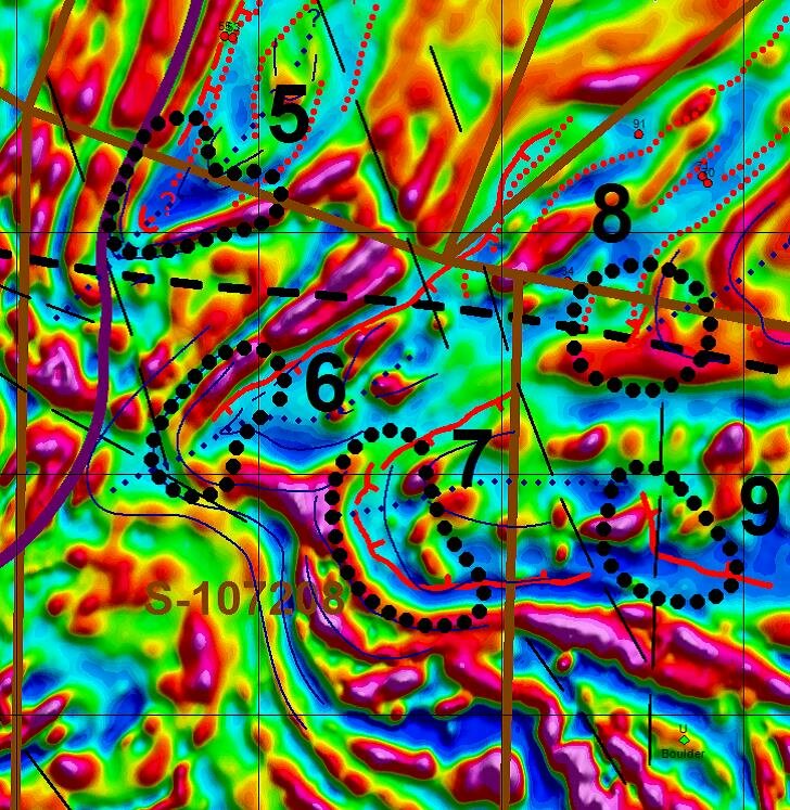
Zones 5 through 9: This is an interesting, complex group of folded magnetic units with good conductor correlation. The VTEM conductor analysis by Condor shows that Zones 5, 6, 7 and probably 9 are within synclinal fold noses. Zone 8 is perhaps an anticlinal fold nose. All the folds in this cluster appear to open to the NE (Zone 5) or to the ENE (Zones 6 through 9). The target cluster is perhaps “up-ice” from U-rich boulders seen near the SE corner of the figure; this may add further exploration interest to the general area.
It is noted that all the synclinal “cores” are quite low in magnetic response – Zones 5, 6, 7, and 9. Geologically, Zones 6, 7, 9, and the south portion of Zone 8 not in the basin, are mapped as being within the pelitic (etc.) schist (Mpsn) unit. Zone 5 is covered by basin sediments, but is likely related to a similar geologic unit. Note also that these low magnetic units are all rather conductive, and are interpreted by Condor as thick basement conductors. Perhaps the shallow-source plate conductors become flatter in dip with depth, connecting continuously through both flanks of the synclines, and presenting a relatively flat conductor at depth – which was modeled as a thick basement conductor. Alternatively and/or additionally, the low magnetic response Mpsn unit may simply be rather conductive. The conductors here are likely graphitic.
More specifically, Zone 5 is a rather tight fold nose opening to the NE. A VTEM conductor dipping to the NE is interpreted by Condor on the fold nose. It is on the east margin of the large intrusive-like (Mgm?) magnetic zone. A NNW magnetic linear is interpreted just west of the target. It is given a medium high initial target priority.
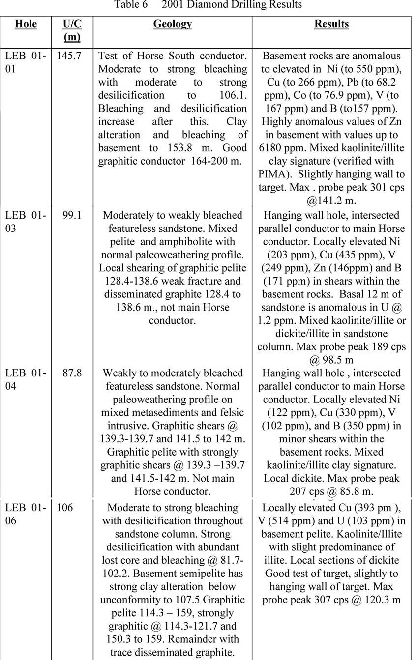
In 2001, JNR Resources completed 4 holes on the project, LEB1, LEB3, LEB 4 and LEB 6. Geochemical analysis of the results was positive for hydrothermal mineralization events.